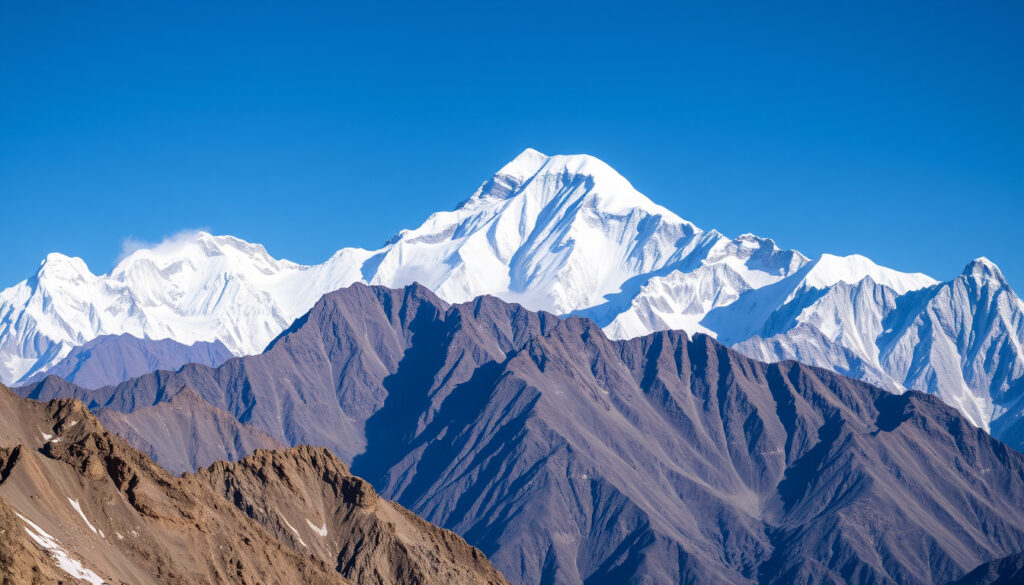
Everest Mountain: Location, Height, Climbing Facts & Safety
Everest has a way of capturing the imagination — even from thousands of miles away, but beyond the postcard images lies a mountain with a surprisingly complex story of borders, measurements, and safety rules. The official height, agreed upon by Nepal and China in 2020, stands at 8,848.86 meters, and the first successful ascent happened in 1953.
Height in meters: 8,848.86 m ·
Height in feet: 29,031.7 ft ·
Location: Mahalangur Himal, Himalayas, border of China and Nepal ·
First ascent: May 29, 1953, by Edmund Hillary and Tenzing Norgay ·
First solo ascent: 1980, by Reinhold Messner ·
Approximate deaths per year: 5–10 (recent average)
Quick snapshot
- Everest sits on the border between Nepal and the Tibet Autonomous Region of China (Britannica (encyclopedia))
- Official height: 8,848.86 m (29,031.7 ft) as of 2020 (BBC News (news outlet))
- First ascent by Edmund Hillary and Tenzing Norgay on 29 May 1953 (Britannica (encyclopedia))
- Whether George Mallory and Andrew Irvine summited before their 1924 disappearance (Britannica (encyclopedia))
- December 8, 2020: Nepal and China jointly announce the current official height of 8,848.86 m (NPR (public radio))
- Newer Nepal expedition rules may penalize ignoring the 2pm turnaround time (Nepal Gateway Trekking (trekking operator))
Six key facts that define the mountain, from its official height to its deadliest years.
| Label | Value |
|---|---|
| Official height | 8,848.86 m (29,031.7 ft) |
| Continent | Asia |
| First climbers | Edmund Hillary & Tenzing Norgay (1953) |
| First solo climber | Reinhold Messner (1980) |
| Border countries | Nepal and China (Tibet) |
| Approximate deaths per year | 5–10 |
Which country is Mount Everest in?
- The summit lies on the border between Nepal (south) and the Tibet Autonomous Region of China (north) (Britannica (encyclopedia)).
- Coordinates: 27°59′17″N 86°55′31″E.
Is Everest in Nepal or China?
Both. The mountain straddles the international border, and the summit is shared territory. The Nepali side calls it Sagarmatha; in Tibetan it is Qomolangma (Nepal Hiking Team (trekking operator)).
What is the exact border location?
Everest sits in the Mahalangur Himal sub-range of the Himalayas (Discovery World Trekking (trekking operator)). The border runs through the summit, meaning climbers from the south approach via Nepal and from the north via Tibet.
Two countries, two sets of permit rules. Nepalese permits are more common, but Chinese permits are also available. The difference in cost and logistics can be tens of thousands of dollars.
What this means: Everest is not “in” one country — it’s a geopolitical twin, and the choice of side dictates everything from the route to the rescue options.
What is the height of Mount Everest in meters, feet, and kilometers?
Three measurements, one official standard since the 2020 joint survey.
What is the official height of Everest in meters?
8,848.86 meters — the figure agreed upon by Nepal and China on December 8, 2020. This replaced the earlier 8,848 m survey from 1955 and China’s 2005 bedrock measurement of 8,844.43 m.
What is Mount Everest height in feet?
29,031.7 feet (commonly rounded to 29,032 ft).
How tall is Everest in kilometers?
8.84886 km — roughly 8.85 km (CNN (news network)). That is about 5.5 miles above sea level.
The 2020 survey used modern GPS and gravity measurements, settling a long-standing disagreement between Nepal and China. The 0.86-meter difference over the previous Nepali figure may sound small, but for surveyors and cartographers, it was a major reconciliation.
The pattern: Height measurements evolve with technology. The earlier 8,848 m figure stood for 65 years; the next update might come when the next survey cycle is triggered by tectonic movement.
Who climbed Mount Everest first?
- First confirmed ascent: 29 May 1953, by Edmund Hillary (New Zealand) and Tenzing Norgay (Nepal/India) (HISTORY (history channel)).
- First solo ascent: Reinhold Messner in 1980, without supplemental oxygen.
- First woman to summit: Junko Tabei in 1975.
Edmund Hillary and Tenzing Norgay
Hillary and Tenzing reached the summit at 11:30 a.m. on May 29, 1953. They were part of a British expedition led by John Hunt. Hillary later described the moment as “exhilarating” and joked that he “knocked the bastard off”.
Messner’s 1980 solo ascent without oxygen demonstrated that the summit was reachable without bottled air, but it also underscored the extreme risk: the death zone above 8,000 m leaves climbers with only hours of safe consciousness.
Why this matters: The first ascents set the stage for thousands of subsequent summits, but they also defined the two main climbing philosophies — with oxygen and team support, or solo and light.
Why do planes not fly over Everest?
- Commercial jets avoid flying directly over Everest because of limited emergency landing options, severe turbulence, and the high altitude requiring special engine and cabin procedures.
- Rerouted routes are common; flights over the Himalayas do occur, but no scheduled routes pass directly over the summit.
Can planes fly over Mount Everest?
Technically yes, but airlines avoid it. The minimum safe altitude for a jet over the Himalayas is around 35,000 feet, and the terrain below offers no emergency runways. A sudden decompression or engine failure could be catastrophic.
What about helicopters?
Helicopters have landed on Everest’s summit, but it is exceptionally dangerous and rare. The thin air at 8,848 m reduces rotor efficiency, making takeoff and landing extremely risky.
The implication: Everest’s height creates a natural no-fly zone for commercial aviation. The pilots who do fly near it must be specially trained, and the route planning is a separate specialty altogether.
How many climbers die on Everest every year?
Between 5 and 10 deaths per year is the recent average, but the figure can spike. In 2023, 17 climbers died.
2023 death toll
17 deaths, making it one of the deadliest seasons on record. The causes included avalanches, falls, and high-altitude illness.
Main causes of death
- Avalanches (e.g., 2014 Sherpa avalanche killed 16)
- Falls and exhaustion in the death zone (above 8,000 m)
- Frostbite and hypothermia
- High-altitude pulmonary or cerebral edema (HAPE/HACE)
The death zone is a zone of no forgiveness. Above 8,000 m, the body’s cells start to die from oxygen deprivation, and even the fittest climbers have only 2–3 days of safe time.
The catch: The death toll is a moving target. Overcrowding, inexperienced climbers, and climate change melting permafrost are all contributing to higher risks each season.
What is the 2pm rule on Mount Everest?
- The 2pm rule: climbers must turn around by 2 p.m. regardless of how close they are to the summit, to avoid dangerous nightfall, exhaustion, and oxygen depletion.
- Enforced by many guide companies; based on fatality analysis showing late summit attempts drastically increase risk.
Why can’t you climb Everest after 2pm?
Because the descent from the summit takes 4–6 hours, and daylight is the only safe window. After 2 p.m., the risk of getting caught in darkness, running out of oxygen, and suffering from hypothermia climbs sharply. Newer Nepal expedition rules may penalize ignoring the turnaround time.
Why this matters: The 2pm rule is not a law — it is a widely practiced safety guideline born from decades of accident data. Treating it as optional is a gamble with your life.
How to climb Everest: a step-by-step guide
Climbing Everest is not a spontaneous adventure. It requires months of planning, significant physical preparation, and a large budget. Here are the essential steps.
- Get fit and acclimatize. Build cardiovascular endurance, strength, and altitude tolerance. Most climbers spend 2–3 months hiking and training at high altitude.
- Choose a route and guide company. The two main routes are the South Col from Nepal and the North Col from Tibet. Both require a certified guide operator.
- Obtain permits and insurance. Nepalese permits cost around $11,000 per person. Chinese permits are similar. Insurance must cover helicopter evacuation and high-altitude rescue.
- Acclimatize on the mountain. The classic itinerary includes 4–6 weeks of rotating between base camp (5,364 m) and higher camps (Camp 1 at 6,065 m, Camp 2 at 6,500 m, etc.) to let the body adjust.
- Summit push with the 2pm rule. Depart from Camp 4 (8,000 m) around midnight, aim for the summit by 1 p.m., and turn around by 2 p.m. at the latest — no exceptions.
- Descend safely. The descent is the most dangerous part. Many deaths occur on the way down due to exhaustion, oxygen depletion, or falls.
The implication: For a first-time 8,000 m climber, the success rate on Everest is around 50–60%. The margin for error is razor-thin, and the 2pm rule is the single most important discipline to master.
Timeline of Everest milestones
From early reconnaissance to the modern era, these events shaped the mountain’s history.
| Date/Period | Event |
|---|---|
| 1921–1924 | Early British reconnaissance and attempts; Mallory and Irvine disappear near summit. |
| 29 May 1953 | First confirmed summit by Hillary and Norgay. |
| 1975 | Junko Tabei becomes first woman to summit. |
| 1980 | Reinhold Messner first solo ascent. |
| 1996 | Disastrous season made famous by Into Thin Air (15 deaths). |
| 2014 | Avalanche kills 16 Sherpas. |
| 2015 | Earthquake causes avalanche, kills 22 on Everest. |
| 2020 | Nepal and China update official height to 8,848.86 m. |
The pattern: Each era brought a new challenge — first the summit itself, then the question of solo climbing, then the tragedy of overcrowding and natural disasters. The 2020 height revision closed a chapter of measurement disputes.
Clarity: what we know vs. what remains uncertain
Confirmed facts
- Everest is located on the border of Nepal and China.
- Official height is 8,848.86 m.
- First ascent by Hillary and Norgay in 1953.
What’s unclear
- Exact fate of Mallory and Irvine (whether they reached summit before death).
- Annual death toll varies and may be underreported.
- 2pm rule is a widely adopted safety guideline but its enforcement remains optional.
The implication: The unresolved questions about Everest’s history and fatalities remind us that even the most studied mountain holds secrets.
Voices from the mountain
“We knocked the bastard off.”
— Edmund Hillary, on the first ascent.
“I climbed Everest without oxygen. It was a lonely, dangerous journey, but it proved that the mountain can be climbed human-powered.”
— Reinhold Messner, reflecting on his 1980 solo ascent.
“The death zone is a place where the body is literally dying, cell by cell. The average mortality rate for climbers above 8,000 m is about 1 in 30.”
— Death zone researcher, cited in Britannica (encyclopedia)
The mountain is not just a statistic — it is a test of human endurance, discipline, and respect for nature. For aspiring climbers, the trade-off is clear: prepare meticulously, respect the 2pm rule, and choose a guide company with a proven safety record, or risk becoming part of the death toll. For the rest of us, the lesson is simpler: some heights are better left to the experts.
Related reading: **Mount Kilimanjaro: Difficulty, Deaths, Oxygen & Beginner Guide** · **Hang Son Doong: World’s Largest Cave Cost & Tours**
en.wikipedia.org, static.hlt.bme.hu, vajiramandravi.com, education.nationalgeographic.org
Readers interested in the precise measurements and geographical context can refer to Everests official height and location for a thorough breakdown.
Frequently asked questions
What is the exact location of Mount Everest on a map?
Everest is located at 27°59′17″N 86°55′31″E, on the border between Nepal and the Tibet Autonomous Region of China. It lies in the Mahalangur Himal sub-range of the Himalayas.
How tall is Mount Everest compared to other mountains?
Everest is the highest mountain on Earth at 8,848.86 m. The second highest, K2, is 8,611 m. Everest is about 238 m taller than K2.
What is the best month to climb Everest?
May is the most popular month, with the best weather window. Pre-monsoon conditions (April–May) offer the most stable winds and temperatures. Post-monsoon (September–October) is also possible but less common.
How much does it cost to climb Mount Everest?
A guided expedition from Nepal costs between $35,000 and $60,000, including permits, guides, oxygen, and logistics. Permits alone are about $11,000 per person.
Do you need oxygen to climb Everest?
Most climbers use bottled oxygen above 8,000 m. A very small number of elite climbers attempt it without, but the risk of death or severe injury is much higher. Reinhold Messner’s 1980 solo ascent without oxygen is the exception, not the rule.
Is Mount Everest growing or shrinking?
Everest is growing slightly due to tectonic plate movement (about 4 mm per year). The 2020 survey confirmed a height increase of 0.86 m over the previous official figure.
Has anyone climbed Everest without oxygen?
Yes – Reinhold Messner was the first, in 1980. Since then, about 200 climbers have summited without supplemental oxygen. It is extremely dangerous and requires superior acclimatization and fitness.
More related posts
 How Old Is Sam Kerr? Age 32, Career & Personal Life
 Selwyn Snow Resort Guide for Families and Beginners
 Rama Duwaji: Ethnicity, Job, Religion & Life as First Lady
 AFLW Grand Final 2025: Kangaroos Win Back-to-Back Title
 16 Guard Haircut – Exact Length, Looks and How-To Guide
 Once Upon a Time in America: Guide to a Masterpiece
 John Jarratt: Career, Net Worth, Wolf Creek 3, and More
 Vitamin D Foods: Best Natural and Fortified Sources