East Coast Low NSW – Warnings, Impacts and Safety Guide
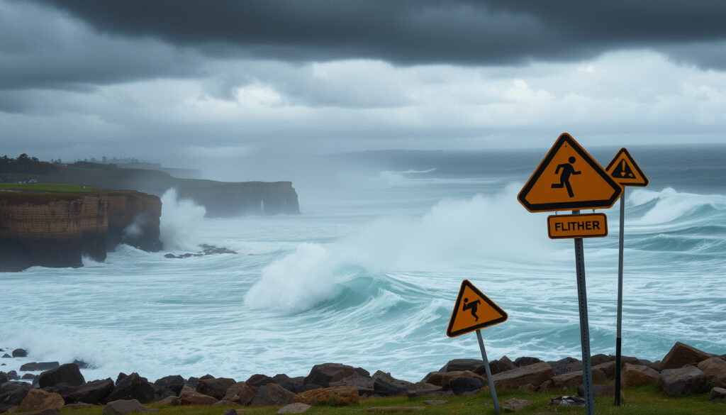
A complex East Coast Low brought severe weather to New South Wales in early July 2025, causing widespread heavy rainfall, damaging winds exceeding 90 km/h, dangerous surf conditions, and significant flood risks across the state’s coastal regions. The system, which developed rapidly off the NSW coast, affected communities from the Mid North Coast through to the Far South Coast, including major population centres such as Sydney, Newcastle, and the Illawarra. Emergency services responded to multiple incidents as the weather system intensified overnight on July 1 and reached peak impact during the day on July 2.
The Bureau of Meteorology issued severe weather warnings for coastal areas, with the NSW State Emergency Service deploying resources across affected regions. Preliminary observations recorded rainfall totals between 100 and 200 millimetres in the 24 hours to 9am on July 2, with Ulladulla on the south coast registering the highest total of 224 millimetres. Authorities urged residents to monitor official updates and take precautions as conditions evolved throughout the event.
What the East Coast Low Brought to NSW: Key Impacts and Current Status
Active severe weather event with warnings current through July 2, 2025
Mid North Coast to Far South Coast, including Sydney, Newcastle, Illawarra, south coast
Heavy rainfall up to 224mm, damaging winds exceeding 90 km/h, moderate flooding possible
BOM Severe Weather Warning and SES alerts via Hazards Near Me App
- Ulladulla recorded 224mm of rainfall in 24 hours, the highest total observed during the event
- Damaging to destructive winds gusted above 90 km/h across multiple coastal locations
- Shoalhaven River faced moderate flooding risk overnight July 2-3
- Second surge of rain and winds expected for south coast, Illawarra, and eastern Victoria on July 2 evening
- Low-pressure system began moving north-northeast by July 2 morning
- Conditions forecast to ease significantly from Thursday, July 3
- Winds and waves expected to subside by Friday, July 4
| Fact | Details |
|---|---|
| System Type | Complex East Coast Low, rapidly deepening off NSW coast |
| Peak Rainfall Observed | 224mm at Ulladulla (24 hours to 9am July 2) |
| Wind Speeds | Gusts exceeding 90-100 km/h, destructive in some coastal and elevated areas |
| Evacuations | No specific evacuations ordered; heightened alert status maintained |
| Widespread Rainfall | 100-200mm from southern Sydney to south coast |
| Duration of Peak Impacts | Approximately 36 hours from July 1 overnight through July 2 |
Which Areas Experienced the Most Severe Conditions?
The south coast bore the brunt of the system, with Ulladulla recording the highest rainfall totals at 224 millimetres. The Illawarra region experienced significant overnight rainfall between 150 and 200 millimetres, while areas from southern Sydney to the south coast saw widespread totals between 100 and 200 millimetres. The heavy rainfall was accompanied by strong winds that affected multiple locations along the coast, contributing to the severe weather pattern that characterised the event.
Major population centres including Newcastle, the Sydney metropolitan area, Illawarra, and the south coast felt the impacts as conditions intensified overnight on July 1. The system’s intensity was particularly notable along coastal areas where the combination of heavy rain, damaging winds, and hazardous surf created dangerous conditions. Spillover effects extended into eastern Victoria and inland mountainous areas as the second surge of rain and winds moved through those regions during the afternoon and evening of July 2.
What Flood Risks Developed During the Event?
Moderate flooding became possible in the Shoalhaven River overnight on July 2 into July 3 as accumulated rainfall worked through river systems. Flood Watches covered multiple areas prone to both flash flooding and riverine flooding, with conditions exacerbated by rainfall that had already saturated catchments. The NSW SES maintained heightened alert levels and prepared for flood and storm impacts across vulnerable regions.
Residents in flood-prone areas should monitor the NSW SES website for real-time warnings and avoid attempting to cross flooded roads. Never enter floodwater, as depths can be deceptive and currents powerful.
Official Warnings and Forecast Guidance from BOM and SES
The Bureau of Meteorology issued a Severe Weather Warning covering damaging winds exceeding 90 to 100 kilometres per hour, heavy rain, and hazardous surf across coastal NSW. The warning extended to southeast Queensland and eastern Victoria, with current status maintained through July 2, 2025. The large low-pressure system rapidly deepened off the coast on July 1 and 2, generating a burst of heavy rain and storms that impacted multiple regions simultaneously.
The NSW State Emergency Service implemented a multi-tiered warning system that included Advice, Watch and Act, and Emergency Warning levels for floods and severe weather. These warnings were accessible through the Hazards Near Me App and the HazardWatch map, providing residents with real-time information to inform their decisions. Emergency services urged preparation for potential impacts and provided multiple contact channels including 132 500 for SES assistance and 000 for life-threatening emergencies.
What Conditions Are Expected as the System Moves Away?
Forecast guidance indicated that rainfall would ease significantly from Thursday, July 3, as the low moved east into the Tasman Sea. The BOM predicted that winds and waves would subside by Friday, July 4, bringing a return to more settled conditions. By July 2 morning, the low had begun moving north-northeast, with the second surge of rain and winds expected to affect the Illawarra, south coast, and eastern Victoria during that afternoon and evening before conditions improved.
Understanding the Science Behind East Coast Lows
East Coast Lows are intense low-pressure systems that develop along Australia’s east coast, typically bringing severe weather including heavy rainfall, strong winds, and rough seas. These systems can form rapidly and often reach their peak intensity while positioned close to the coast, making them particularly dangerous for coastal communities. The July 2025 event demonstrated characteristics typical of significant East Coast Lows, including rapid deepening, concentrated heavy rainfall, and widespread wind impacts across populated areas.
The interaction between cold air from the south and warm moist air from the Tasman Sea creates conditions favourable for rapid intensification. Coastal areas, especially those exposed to the east and southeast, typically experience the most severe impacts from these systems. The orientation of the coastline and local topography can amplify wind speeds and rainfall amounts in certain regions, contributing to the variation in observed impacts across different areas.
Residents in coastal NSW should maintain emergency kits and stay informed during East Coast Low season, which typically peaks during autumn and winter months. Monitor official BOM forecasts and SES warnings during active weather events.
How Do East Coast Lows Compare to Other Australian Weather Systems?
Unlike tropical cyclones that develop over warm ocean waters, East Coast Lows can form in cooler temperatures and often interact with cold fronts from the south. This atmospheric interaction contributes to the rapid intensification that characterises these events. While cyclones typically affect northern Australia, East Coast Lows specifically impact the populated coastal regions of NSW and Queensland, making them particularly significant for emergency management planning in those areas.
Chronological Timeline of the July 2025 East Coast Low
Understanding the sequence of events helps residents and emergency services track the progression of significant weather systems and plan their responses accordingly. The following timeline captures key milestones from the July 2025 East Coast Low based on available BOM and SES data.
- July 1, overnight: The East Coast Low deepened rapidly off the NSW coast, bringing initial heavy rainfall of up to 150 millimetres widespread, storms, and strong winds that impacted coastal areas.
- July 2, morning: Peak impacts occurred with 224 millimetres recorded at Ulladulla and wind gusts exceeding 90 kilometres per hour. The low’s circulation was visible on weather radar positioned near the coast.
- July 2, afternoon and evening: A second surge of rain and winds moved through the south coast, Illawarra, and eastern Victoria, extending the severe conditions across multiple regions.
- July 3, Thursday: Rainfall began easing as the low moved further east into the Tasman Sea, with conditions gradually improving across most affected areas.
- July 4, Friday: Winds and surf subsided as the system moved away, bringing a return to more stable weather patterns for coastal NSW.
What Is Confirmed Versus What Remains Forecast?
Established Information
- East Coast Low impacted NSW from July 1-2, 2025
- Ulladulla recorded 224mm of rainfall
- Widespread rainfall of 100-200mm observed
- Winds gusted above 90 km/h
- Shoalhaven River faced moderate flooding risk
- BOM issued Severe Weather Warnings
- SES provided multi-level warnings
- System moved east by July 3
Forecast Information
- Conditions easing from July 3 (confirmed via forecast)
- Winds and waves subsiding by July 4 (projected timeline)
- Second surge affecting specific regions on July 2 evening (forecast-based)
- Future intensity influenced by ENSO conditions (ongoing monitoring)
The Significance of East Coast Lows for NSW Coastal Communities
East Coast Lows represent some of the most significant weather events affecting NSW, with the potential to cause widespread damage across populated coastal areas. The July 2025 event demonstrated how quickly conditions can deteriorate when these systems develop, with impacts spanning hundreds of kilometres of coastline within a 36-hour period. The concentration of rainfall in coastal areas, combined with the flat nature of much of the coastal terrain, creates particular challenges for flood management and emergency response.
Major population centres along the coast, including Sydney, Newcastle, and the regional centres of the Illawarra and south coast, face ongoing exposure to these events. Infrastructure including roads, powerlines, and drainage systems can be significantly affected when rainfall totals reach the levels observed during this event. The cumulative effect of heavy rainfall on already saturated catchments increases the risk of both flash flooding and prolonged riverine flooding in the days following the peak impacts.
Official Sources and Statements on the Event
NSW State Emergency Service information highlighted the importance of monitoring the Hazards Near Me App and HazardWatch map for real-time updates. Residents were urged to prepare for impacts and contact 132 500 for SES assistance or 000 for life-threatening emergencies.
The Bureau of Meteorology emphasised monitoring conditions through official BOM website channels or the Weather app. Safety guidance included avoiding fallen powerlines by staying at least eight metres clear, using generators only outdoors to prevent carbon monoxide poisoning, and checking road conditions through Live Traffic NSW before travelling. These measures reflect the ongoing emphasis on personal preparedness during severe weather events.
The BOM Severe Weather Warning explicitly noted damaging winds exceeding 90-100 km/h, with destructive conditions possible in some coastal and elevated areas. Heavy rain and hazardous surf were forecast across coastal NSW extending to southeast Queensland and eastern Victoria.
What Residents Should Know About Monitoring and Safety
Staying informed during East Coast Low events requires regular monitoring of official sources rather than relying on social media or informal channels. The NSW SES and BOM provide the most accurate and timely information about current conditions and forecast changes. The Hazards Near Me App delivers location-specific warnings based on the user’s proximity to affected areas, making it a valuable tool for residents in active warning zones.
Preparation before severe weather arrives significantly improves outcomes for individuals and families. Securing loose outdoor items, ensuring emergency supplies are accessible, and understanding evacuation routes for low-lying areas all contribute to resilience. During active events, avoiding unnecessary travel, staying away from flooded roads and waterways, and maintaining communication with vulnerable neighbours supports community safety. For more detailed information on emergency preparedness resources, residents can consult relevant NSW government services.
Frequently Asked Questions About the July 2025 East Coast Low
What is an East Coast Low?
An East Coast Low is an intense low-pressure system that develops along Australia’s east coast, typically bringing severe weather including heavy rainfall, strong winds, and rough seas. These systems form when cold air from the south interacts with warm moist air from the Tasman Sea, creating conditions that can lead to rapid intensification close to populated coastal areas.
Which areas were most affected by the July 2025 event?
The south coast, particularly Ulladulla with 224mm of rainfall, experienced the most severe impacts. The Illawarra region, Sydney metropolitan area, and Newcastle also felt significant effects from heavy rainfall and damaging winds. Eastern Victoria experienced spillover effects during the second surge of the system.
What wind speeds were recorded during the event?
Damaging to destructive winds gusting above 90 kilometres per hour were recorded across multiple coastal locations. Some coastal and elevated areas experienced gusts reaching 100 km/h, which the Bureau of Meteorology classified as destructive in specific areas.
Were any evacuations ordered during the East Coast Low?
No specific evacuations were detailed in the available data. However, the NSW SES maintained heightened alert levels and issued warnings at Advice, Watch and Act, and Emergency Warning levels, preparing for potential flood and storm impacts across affected regions.
How can I stay informed about weather warnings in NSW?
Monitor the Bureau of Meteorology website and the Hazards Near Me App for real-time updates. The NSW SES website at ses.nsw.gov.au provides current warnings, while Live Traffic NSW offers road condition information. For emergencies, contact 000 or the SES on 132 500.
When did conditions improve after the peak of the event?
Rainfall was forecast to ease significantly from Thursday, July 3, as the low moved east into the Tasman Sea. Winds and waves were expected to subside by Friday, July 4, with the system moving away from the coast and conditions returning to more settled patterns.
What was the highest rainfall recorded during the event?
Ulladulla on the south coast recorded the highest rainfall total at 224 millimetres in the 24 hours to 9am on July 2. The Illawarra region saw 150-200 millimetres overnight into July 2, while widespread totals of 100-200 millimetres were observed from southern Sydney to the south coast.
Is this event related to any climate patterns like ENSO?
The July 2025 event stands as a significant historical occurrence in the data. ENSO updates from the Bureau indicate neutral conditions with potential warming, which could influence future storm intensity. However, direct attribution of this specific event to ENSO patterns was not detailed in the available information.
More related posts
 Richard Ayoade: Real Name, Family, Wife, Touch Aversion
 Builder Near Me: Hiring, Co t & Rule in Ireland
 Barbra Streisand 2024: Health, Relationships, and Latest Updates
 Don Bradman: 99.94 Average, 22-Ball Century Myth & Records
 USA at Milano Cortina 2026: Schedule, Bans & Pay
 Best Performing Super Funds in Australia: Top 10 Ranked
 Cast of The Wrecking Crew 2026: Full List of Actors & Roles
 Big W Redbank: Hours, Location, Phone & Stock Check